- FastCompany -
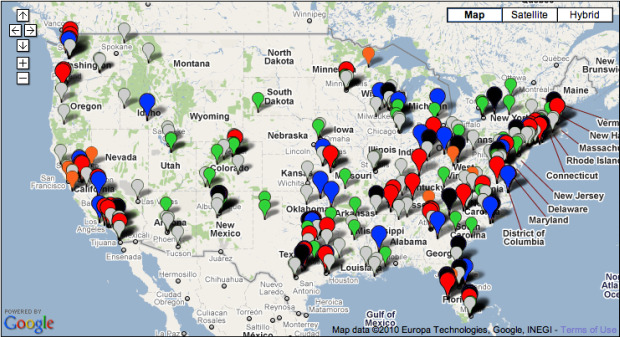
The Cato Institute has put together something it calls a Raid Map, using Google Maps to show all the paramilitary raids done by government agencies that haven't quite worked out the way they should have. Or, as the Cato Institute puts it, "botched."
The different colored pins signify different ways each raid went wrong, from the deaths of officers and innocents, through mistaken identity, to overuse of force, and you can isolate the data by state, year and type of cock-up, should you so wish.
"Defenders of SWAT teams and paramilitary tactics say such incidents are rare," says the Institute. "The map below aims to refute that notion" -- as do the recently reported, tragic shooting deaths of a 7-year-old girl in Detroit and this guy's dog. Just think how much more refuting the map could have done had they opened it up to crowdsourcing.
No comments:
Post a Comment